Tag Archives: invasive species

Howard Buford Recreation Area/Mt. Pisgah

View of the Middle Fork

July 6, 2011

I drove south from Skinner Butte to the 30th Avenue Exit #189 and stopped at SeQuential Biofuels Station No. 1.  I hate gas stations and I didn’t need gas, but SeQuential has great coffee and wonderful natural, local food so I stopped to pick up lunch.  The station already has a Tesla electric vehicle (EV) charging station and I hope they get to participate in the EV Highway charging network.  You can already get biofuel there, as well as standard gasoline.

From the station I went east to the Howard Buford Recreation Area, a 2,363-acre Lane County Park.  I parked and started up the Theodore Trail through oak/fir woods before breaking out onto grasslands and connecting with the main Beistel’s West Summit Trail.  A trail map is available online.  Bill Sullivan says that, “The first Lane County pioneers climbed this grassy hill between the forks of the Willamette River, viewed the green dales at the end of the Willamette Valley, and named the hill Mount Pisgah, for the Biblical summit from which Moses sighted the Promised Land.”

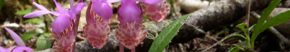
The trail was busy on a midweek morning with walkers, runners and families of all shapes and sizes.  Flowers, native and invasive, blew in the wind.

At the top, the author Ken Kesey, from Pleasant Valley, contributed a lovely sculpture that shows the topography of the area and the fossils, fish and wildlife found here.  He must have looked up at Mt. Pisgah nearly every day of his life.

I sat on a bench just east of the summit looking south toward the Calapooia Mountains and eating my lunch before heading back to the car by the Arboretum. A group of kids from a day care center was eating lunch in the White Oak Pavilion.  I strolled out to an oak grove imagining all the picnics here over the years.

Willamette Confluence-Restoration Challenges

Himalayan Blackberries and Oaks

A walk on the Willamette Confluence property shows stark contrasts between riparian cottonwood stands and an upland oak grove in good condition and the old gravel pits and heavy construction equipment areas.  Invasive species dominate the land.  I’ve never seen such huge hedges and fields of Himalayan blackberry.  TNC mowed the oak upland area as a first step in eradication, but they have to evaluate carefully where they want to take action and where they don’t.  For example, the blackberries on the riverbank are good at preventing trespass and some of the other blackberries may drown as channels are reconnected.  Where they mowed the blackberries, ox-eye daisies have now bloomed.  Wild cucumber vines climb the blackberry hedges and the old farm field is full of mullein.

Oak Galls

We ate lunch under an oak looking out over the Middle Fork.  TNC is focusing early restoration work here, focusing on clearing out the Douglas fir to release the oak.  The oak savanna exists because Wildish logged the Douglas fir years ago.  It was very controversial when they did it, but it opened up the oak.  The hill abuts Lane County’s Howard Buford Recreation Area where you can see the oaks being crowded out by fir.  The importance of managing the various ownerships together is obvious when you look at the blackberry hedge and field on the Lane County property adjacent to the area TNC just cleared.

The magnitude of the native vegetation restoration is overwhelming.  TNC has the expertise to tackle it, but even they find the scale of this project to be daunting.  It requires lots of strategic decisions about priority setting and sequencing.  But the promise is also clear.  Longtime Lane County Commissioner Bill Dwyer appropriately notes in a recent video that acquisition of the Wildish lands has been a 40-year regional goal, complementing decades of investment in adjacent recreation lands by Lane County, Oregon Parks and Recreation and Willamalane Park District.  Commissioner Dwyer and Dan Bell both talk about the legacy the project will leave to their children, grandchildren and great-grandchildren.  The Willamette Confluence property combined with the other public lands in the vicinity bring the total public ownership to over 5,000 acres, a major public investment with tremendous restoration opportunities if all the public owners can develop a shared management vision.


Mary S. Young State Park

June 9, 2011

Mary S. Young Viewpoint looking south

How many times have you driven on Highway 43 between Lake Oswego and I-205 and seen the sign for Mary S. Young State Recreation Area?  Did you ever wonder who she was and what the park was like?  Today I stopped and drove in for the first time.  Mike Houck is right in his book Wild in the City–the park has something for everyone in 133 acres.

In addition to off leash dog areas and soccer fields, it has nearly eight miles of trails through wooded canyons, across bluffs and along the river.  The City of West Linn manages the area for the state and has great trail maps.  The City is also close to adopting a Trails Master Plan for inclusion in their comprehensive plan.  You can see the work of engaged citizens on the trails where they have worked hard to remove invasive species and plant natives.

The park wouldn’t be here at all if it weren’t for the vision and dedication of Mary Scarsborough Young who bought the property as a farm retreat.  She was a leading citizen of Lake Oswego where she volunteered for countless civic projects from the 1930s until her death.  She planned to build a house and tennis courts and you can see the results of her work in the lovely rock walls and terraces and garden  perennials  throughout the park.  She donated the property to the state. She and the citizen volunteers embody C.E.S. Wood’s saying, “Good citizens are the riches of a city.”

Hearing the cry of a pileated woodpecker in the middle of the city is astonishing.  The paths were busy with runners, young couples walking hand in hand, and people walking their dogs.  The river is so high that the waterfront trails and the bridge to Cedar Island are flooded.  But the view of the river, dotted with salmon fishing boats and a sightseeing jet boat, was as inspiring today as it probably was to Mrs. Young.

I’m reading Richard Louv’s new book, The Nature Principle: Human Restoration and the End of Nature-Deficit Disorder, and parks like Mary S. Young put us at the forefront of connecting people to the natural world for personal restoration and community building.

Clackamas River Restoration

During my May 25, 2011 fishing trip, we talked about restoration efforts in the Clackamas Basin.  I thought that the Clackamas produced more salmon and steelhead historically than any other part of the Willamette system.  Livingston Stone of the U.S. Fish Commission thought the same thing when he was evaluating potential hatchery sites in 1877.  He said, “probably no tributary of the Columbia has abounded so profusely with salmon in past years as this river.”  This suggested to me that we should be putting more effort into restoration of the Clackamas than some of the other rivers.

All the guys agreed about the importance and size of the Clackamas runs, noting that since the mouth is below the Falls at Oregon City, it has runs of spring Chinook, fall Chinook, winter steelhead and coho with fish in the river throughout the year.   But they were quick to emphasize the importance of the small tributary streams all along the Clackamas and the mainstem Willamette.  Bob said he thinks they act like rest areas for the fish as they go out to sea and come back.  The whole chain needs to be healthy for the runs to thrive.

I asked what the other threats were to the health of the river.  Riz immediately said invasive species.  By then we were near his house fishing another hole.  He described exactly where the summer steelhead lie just off a ledge and when to fish for them with flies.  And he pointed out all of the knotweed and scotch broom along the shore, explaining how hard it is to get rid of the knotweed and its impact on native species.  Some may wonder about the connection between invasive species and river restoration, but as we learn more about the nutrient cycle between the fish and the riparian habitat, Riz’s comment makes a lot of sense.

The major water quality issues are municipal wastewater discharges and agricultural runoff, especially in Deep Creek.  Only an eighth of the entire basin is agricultural, mostly nursery stock, Christmas trees and livestock.  Past timber harvest had an impact by raising temperatures on the tributaries.  The big challenge could be municipal water diversions, although most of them are near Oregon City.  Ten percent of Oregon’s population already gets its water from the Clackamas and that could grow.  If all of the municipal rights were developed, they worry that the river could be dewatered.  Irrigation is less of a threat due to the return flows.

Bill asked what had happened to the old gravel operations along the river, specifically the “gravel hole.”  Bob and Doug said that it is restoring itself with the river capturing the old pit.  I wonder how much gravel mining there still is and what is happening to all the reclaimed areas.